

Hydrological Analysis
Watershed Delineation
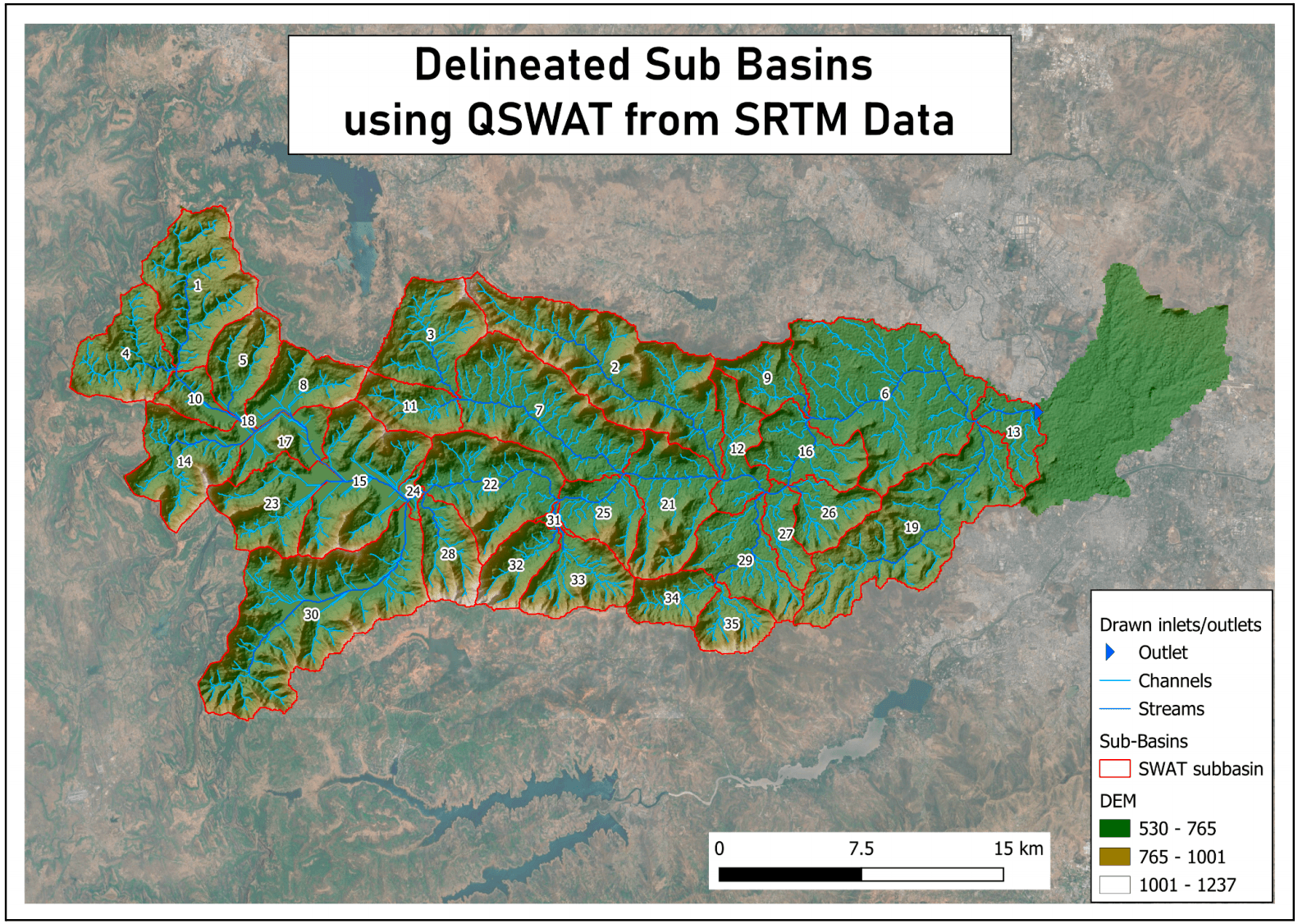
Comparing elevation data sources to identify the optimal resolution for critical water management decisions, resulting in significantly improved stream delineation and sub-basin boundary mapping for the Mula river watershed.
Use Case
Elevation Data Comparison
Finding the Best Data Source for Water Management
Our analysis compared SRTM and CartoDEM elevation datasets to determine which provides more accurate watershed delineation for the Mula river basin in Maharashtra.The Challenge
Water resource managers required reliable stream network and watershed boundary data that reflected actual conditions. Existing data showed discrepancies that affected planning decisions.
Our Methodology
We processed both 30m SRTM and 10m CartoDEM data through identical workflows using QSWAT. This included mosaicing, projection transformation, and stream generation with consistent thresholds of 50 and 2500 acres for channel and stream identification.
Critical Findings
CartoDEM data delivered superior results, particularly in urban environments where stream alignment matched ground conditions significantly better. The analysis revealed that many streams in official databases don't actually exist on the ground.
Technical Approach
Using the Mula River barrage as our outlet point, we delineated sub-basins with both datasets and compared results against India-WRIS authoritative sources and high-resolution imagery.
Tangible Impact
The analysis provided decision-makers with confidence in selecting appropriate elevation data sources, leading to more accurate water resource planning and improved flood risk assessment capabilities.
This Worked for Them — Could It Work for You?
Let’s talk through whether it makes sense for your team.